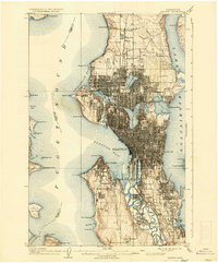
1909 Map of Seattle
USGS Topo · Published 1936About this map
The Alaska-Yukon-Pacific Exposition grounds and the State University campus dominate the landscape of early 20th-century Seattle, reflecting a period of rapid urban transformation and civic ambition. This 1908 culture revision documents a city defined by its complex waterways, from the busy industrial shoreline of Elliott Bay to the emerging residential districts near Green Lake and Lake Union. The expansion of the city is evident in the dense street grids of Ballard and South Seattle, while the meandering course of the Duwamish River remains largely unstraightened, winding past Georgetown and South Park.
Find a feature on this map
81 named features on this map. Tap any name to fly to it.
Don’t see what you’re looking for? This feature index may not catch every label — zoom into the map to look around manually.
Map Details
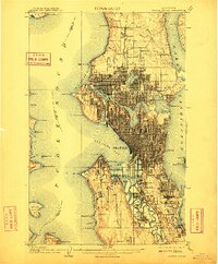
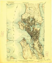
Editions of this 1909 Seattle Map
4 editions found
Other maps of this area

1894 · Seattle
USGS Topo · 1:62,500

1895 · Snohomish
USGS Topo · 1:125,000

1897 · Tacoma
USGS Topo · 1:125,000

1897 · Seattle
USGS Topo · 1:125,000

1900 · Tacoma
USGS Topo · 1:125,000

1908 · Seattle
USGS Topo · 1:62,500

1909 · Seattle Special
USGS Topo · 1:62,500

1937 · Port Orchard
USGS Topo · 1:62,500

1937 · Port Gamble
USGS Topo · 1:62,500

1940 · Port Gamble
USGS Topo · 1:62,500