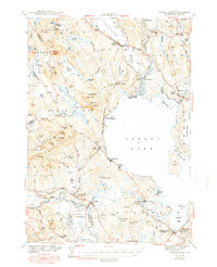
1943 Map of Sebago Lake
USGS Topo · Published 1949About this map
The Crooked River and Songo Lock define the interior waterways of this 1940s landscape, connecting the expansive waters of Long Lake to the northern reaches of Sebago Lake. This survey captures the region's mid-century transition, where established lakeside settlements like Naples and South Casco sit alongside the dense forest and granite peaks of Saddleback Mountain and Douglas Mtn. The Maine Central Railroad cuts across the southern portion of the sheet, serving industry and travel at Steep Falls and Mattoeks Sta. Educational and community centers such as Potter Academy in Sebago and several rural schoolhouses, including the Larrabee Sch and Hawthorne Sch, provide specific points of interest for genealogists tracing local family footprints. The map also documents the early footprint of Sebago Lake State Park, established just years prior to this survey.
Find a feature on this map
116 named features on this map. Tap any name to fly to it.
Don’t see what you’re looking for? This feature index may not catch every label — zoom into the map to look around manually.
Map Details
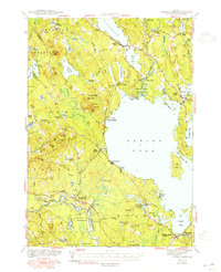
Editions of this 1943 Sebago Lake Map
3 editions found

Other maps of this area

1891 · Portland
USGS Topo · 1:62,500

1891 · Buxton
USGS Topo · 1:62,500

1891 · Newfield
USGS Topo · 1:62,500

1892 · Buxton
USGS Topo · 1:62,500

1893 · Portland
USGS Topo · 1:62,500

1893 · Buxton
USGS Topo · 1:62,500

1893 · Newfield
USGS Topo · 1:62,500

1894 · Gray
USGS Topo · 1:62,500

1896 · Norway
USGS Topo · 1:62,500

1896 · Sebago
USGS Topo · 1:62,500