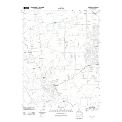
2012 Map of Sebastopol
USGS Topo · Published 2012About this map
Sebastopol serves as the focal point of this 2012 survey, situated amidst the complex wetland hydrology of the Laguna de Santa Rosa. The landscape is a patchwork of viticulture and small agricultural settlements, featuring numerous wineries such as Dehlinger Winery and Martini and Prati Winery. To the north, the terrain transitions into the gentle rises of Vine Hill, while the Santa Rosa Creek and Atascadero Creek drainage systems define the local topography. This era shows a well-established network of rural roads and residential clusters at Sousa Corners, Graton, and Barlow. For genealogists, several burial grounds are recorded, including the Steele Family Cemetery and Fulton Cemetery, providing important spatial context for family roots in this part of Sonoma County.
Find a feature on this map
105 named features on this map. Tap any name to fly to it.
Don’t see what you’re looking for? This feature index may not catch every label — zoom into the map to look around manually.
Map Details
Editions of this 2012 Sebastopol Map
This is the sole edition of this map. No revisions or reprints were ever made.
Other maps of this area

1916 · Santa Rosa
USGS Topo · 1:62,500

1920 · Healdsburg
USGS Topo · 1:62,500

1927 · Calistoga
USGS Topo · 1:62,500

1933 · Healdsburg
USGS Topo · 1:48,000

1935 · Sebastopol
USGS Topo · 1:48,000

1940 · Healdsburg
USGS Topo · 1:62,500

1942 · Sebastopol
USGS Topo · 1:62,500

1943 · Calistoga
USGS Topo · 1:62,500

1944 · Santa Rosa
USGS Topo · 1:62,500

1945 · Calistoga
USGS Topo · 1:62,500