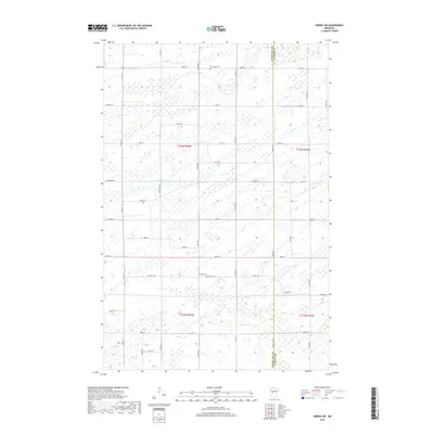
2019 Map of Sebeka SW
USGS Topo · Published 2019About this map
The county line between Otter Tail Co and Wadena Co defines the eastern edge of this rural landscape, where a dense network of sectional roads connects small agricultural plots and wetlands. Local history and genealogy are anchored by two burial grounds: Hay Creek Cem in the north and Pioneer Cem toward the center, the latter situated near the junction of Co Hwy 144 and Co Hwy 75. The terrain is characterized by the meandering paths of Hay Cr and Blue Cr, which drain through numerous low-lying marshy areas. The mapping of the Public Land Survey System (PLSS) divisions, including t136n r36w and t135n r36w, reveals the grid-based settlement pattern common to this region of Minnesota, providing a clear reference for property research and land-use analysis.
Find a feature on this map
48 named features on this map. Tap any name to fly to it.
Don’t see what you’re looking for? This feature index may not catch every label — zoom into the map to look around manually.
Map Details
Editions of this 2019 Sebeka SW Map
This is the sole edition of this map. No revisions or reprints were ever made.
Other maps of this area

1953 · Brainerd
USGS Topo · 1:250,000

1957 · Brainerd
USGS Topo · 1:250,000

1958 · Brainerd
USGS Topo · 1:250,000

1965 · Brainerd
USGS Topo · 1:250,000

1969 · Sebeka SW
USGS Topo · 1:24,000

1969 · Sebeka
USGS Topo · 1:24,000

1969 · Sebeka NW
USGS Topo · 1:24,000

1969 · Wadena
USGS Topo · 1:24,000
1969 · Deer Creek
USGS Topo · 1:24,000

1969 · Verndale
USGS Topo · 1:24,000