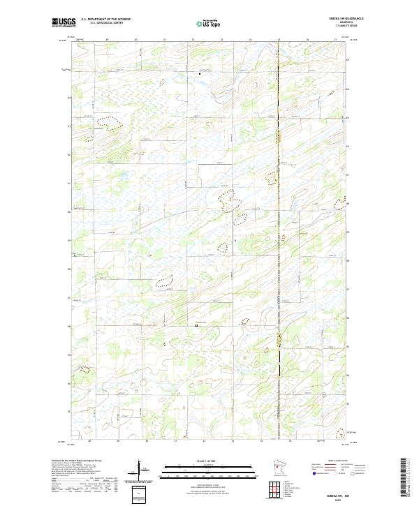
2022 Map of Sebeka SW
USGS Topo · Published 2022About this map
Hay Creek and Blue Creek weave through this section of the Minnesota lake country, defining a landscape dominated by extensive wetlands and a geometric grid of rural section roads. The boundary between Otter Tail County and Wadena County runs north-to-south along Wadena Line RD, a significant geographical marker for local researchers. This 2022 survey documents the persistent rural character of the region, where the primary landmarks are small family burial grounds and county thoroughfares rather than dense settlements. Genealogists will find Hay Creek Cem in the north and Pioneer Cem further south, both situated near the township lines of t136n r36w and t135n r36w. The map preserves the specific configuration of county routes like Co Hwy 19 and Co HWY 144 as they navigate the low-lying marshy terrain.
Find a feature on this map
38 named features on this map. Tap any name to fly to it.
Don’t see what you’re looking for? This feature index may not catch every label — zoom into the map to look around manually.
Map Details
Editions of this 2022 Sebeka SW Map
This is the sole edition of this map. No revisions or reprints were ever made.
Other maps of this area

1953 · Brainerd
USGS Topo · 1:250,000

1957 · Brainerd
USGS Topo · 1:250,000

1958 · Brainerd
USGS Topo · 1:250,000

1965 · Brainerd
USGS Topo · 1:250,000

1969 · Sebeka SW
USGS Topo · 1:24,000

1969 · Sebeka
USGS Topo · 1:24,000

1969 · Sebeka NW
USGS Topo · 1:24,000

1969 · Wadena
USGS Topo · 1:24,000
1969 · Deer Creek
USGS Topo · 1:24,000

1969 · Verndale
USGS Topo · 1:24,000