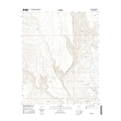
2017 Map of Seboyeta
USGS Topo · Published 2017About this map
Seboyeta and Bibo anchor this high-elevation landscape where canyons and mesas define the local geography. The settlement pattern follows the drainage of Rio Paguate, which flows southeast past Encinal and the village of Paguate. To the north, the terrain rises sharply toward Mesa Chivato, cut by the deep incisions of Big Canyon and Seboyeta Canyon. The road network, including Taylor Ranch Rd and Alamo Ranch Rd, reflects a history of ranching and remote access in this part of Cibola County. Notable for genealogists is the Paguate Cem, located on the eastern edge of the Paguate settlement near Old Bridge Rd. The map illustrates a transitional landscape where the water of Seboyetita Cr and Encinal Cr has historically dictated the location of homes and livestock routes.
Find a feature on this map
38 named features on this map. Tap any name to fly to it.
Don’t see what you’re looking for? This feature index may not catch every label — zoom into the map to look around manually.
Map Details
Editions of this 2017 Seboyeta Map
This is the sole edition of this map. No revisions or reprints were ever made.
Other maps of this area

1883 · Mt. Taylor
USGS Topo · 1:250,000

1886 · Mt. Taylor
USGS Topo · 1:250,000

1892 · Mt. Taylor
USGS Topo · 1:250,000

1899 · Mt. Taylor
USGS Topo · 1:250,000

1957 · Mount Taylor
USGS Topo · 1:24,000

1957 · Laguna
USGS Topo · 1:24,000

1957 · Moquino
USGS Topo · 1:24,000

1957 · Cubero
USGS Topo · 1:24,000

1957 · Seboyeta
USGS Topo · 1:24,000

1957 · Mesita
USGS Topo · 1:24,000