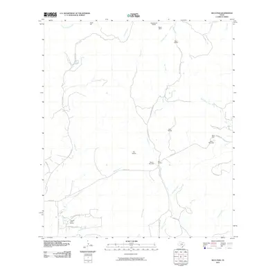
2010 Map of Seco Pass
USGS Topo · Published 2010About this map
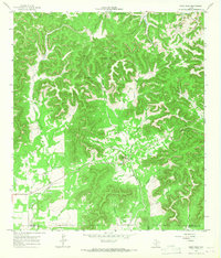
Sentry Mountain and Seco Mountain overlook a landscape defined by the drainage networks of the Texas Hill Country. This 2010 survey of the area near Seco Pass illustrates a region dominated by ranching and rural transit, with winding routes like Seco Springs Ranch Rd and Ranch Rd 470 following the natural contours of the land. The presence of Haby Cemetery and the Thunder Creek Airport indicates the scattered but persistent human footprint in this part of Medina County. Numerous watercourses, including Seco Creek, Pigeon Roost Creek, and Bravo Creek, carve through the terrain, creating a series of named valleys such as Buck Hollow and Hay Hollow. The map provides a clear view of the complex hydrography and local landmarks that have served generations of residents and land managers in the region.
Find a feature on this map
37 named features on this map. Tap any name to fly to it.
Don’t see what you’re looking for? This feature index may not catch every label — zoom into the map to look around manually.
Map Details
Editions of this 2010 Seco Pass Map
This is the sole edition of this map. No revisions or reprints were ever made.
Other maps of this area

1954 · San Antonio
USGS Topo · 1:250,000

1956 · Tarpley
USGS Topo · 1:62,500

1956 · Tuff
USGS Topo · 1:62,500

1956 · Utopia
USGS Topo · 1:62,500

1957 · San Antonio
USGS Topo · 1:250,000

1964 · Sabinal Canyon
USGS Topo · 1:24,000
1964 · Love Creek
USGS Topo · 1:24,000
1964 · A Bar A Ranch
USGS Topo · 1:24,000
1964 · Tarpley
USGS Topo · 1:24,000
1964 · Seco Pass
USGS Topo · 1:24,000