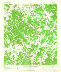
1964 Map of A Bar A Ranch
USGS Topo · Published 1967About this map
The Medina River and its multiple headwater forks carve through this section of the Texas Hill Country, defining a landscape dominated by livestock ranching and rural family homesteads in the early 1960s. The convergence of the North Prong Medina River and West Prong Medina River serves as a focal point for settlement, where the A Bar A Ranch and Rocky River Ranch are situated among numerous smaller operations like the Horse Valley Ranch. Local genealogy is deeply etched into the land through family-named sites such as Means Cem, Goodman Cem, and Baker Cem. The map reveals a specialized infrastructure for this remote terrain, including multiple private Landing Strips and a Jeep Trail winding through Rhyme Hollow, illustrating how these ranching communities maintained connectivity before more modern road networks reached deep into the canyons.
Find a feature on this map
36 named features on this map. Tap any name to fly to it.
Don’t see what you’re looking for? This feature index may not catch every label — zoom into the map to look around manually.
Map Details
Editions of this 1964 A Bar A Ranch Map
2 editions found
Other maps of this area

1954 · San Antonio
USGS Topo · 1:250,000

1956 · Tarpley
USGS Topo · 1:62,500

1956 · Tuff
USGS Topo · 1:62,500

1956 · Bandera
USGS Topo · 1:62,500

1956 · Center Point
USGS Topo · 1:62,500

1957 · San Antonio
USGS Topo · 1:250,000

1964 · Diamond S Ranch
USGS Topo · 1:24,000

1964 · Echo Hill Ranch
USGS Topo · 1:24,000
1964 · Love Creek
USGS Topo · 1:24,000

1964 · Rock Cliff Reservoir
USGS Topo · 1:24,000