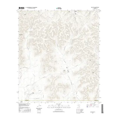
2016 Map of Seco Pass
USGS Topo · Published 2016About this map
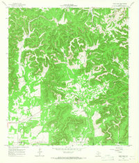
Utopia anchors the southwestern corner of this Hill Country landscape, where the confluence of several seasonal and perennial waterways defines the local geography. The area is marked by a complex network of ranch roads and valley passages, including the significant Seco Pass and Seco Mtn in the east. Numerous creeks, such as Seco Cr and Bravo Cr, drain through deep hollows like Sutherland Hollow and Buck Hollow, illustrating a terrain shaped by persistent hydraulic action. Evidence of long-standing local ranching and settlement is visible in the placement of the Haby Cem and several private ranch roads like Frazier Ranch Rd. The inclusion of the Thunder Creek Airport reflects modern aviation needs within this otherwise rural expanse. This map provides a detailed look at the transitions between Bandera, Medina, and Uvalde counties.
Find a feature on this map
52 named features on this map. Tap any name to fly to it.
Don’t see what you’re looking for? This feature index may not catch every label — zoom into the map to look around manually.
Map Details
Editions of this 2016 Seco Pass Map
This is the sole edition of this map. No revisions or reprints were ever made.
Other maps of this area

1954 · San Antonio
USGS Topo · 1:250,000

1956 · Tarpley
USGS Topo · 1:62,500

1956 · Tuff
USGS Topo · 1:62,500

1956 · Utopia
USGS Topo · 1:62,500

1957 · San Antonio
USGS Topo · 1:250,000

1964 · Sabinal Canyon
USGS Topo · 1:24,000
1964 · Love Creek
USGS Topo · 1:24,000
1964 · A Bar A Ranch
USGS Topo · 1:24,000
1964 · Tarpley
USGS Topo · 1:24,000
1964 · Seco Pass
USGS Topo · 1:24,000