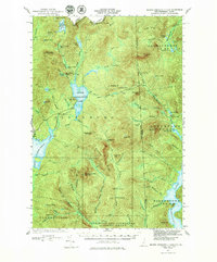
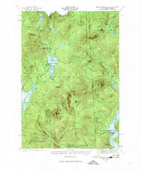
1927 Map of Second Connecticut Lake
USGS Topo · Published 1980About this map
Pittsburg township in northernmost New Hampshire defines this 1927 landscape, where the headwaters of the Connecticut River begin their southward journey. The map reveals a wild, industrial-frontier character dominated by logging activity, evidenced by numerous numbered outposts like Camp No 8 and Camp No 36 scattered through the drainages of the Dead Diamond River and Magalloway River. The presence of the Schoppe Dam at Scott Bog and early lakeside developments at Idlewild and Camp Otter mark the early 20th-century transition toward managed water resources and remote seasonal recreation. High summits such as Magalloway Mtn and Deer Mtn, both featuring a Fire Tower, provide the literal high points for a region defined by its proximity to the Canada-United States border and the Maine-New Hampshire line.
Find a feature on this map
94 named features on this map. Tap any name to fly to it.
Don’t see what you’re looking for? This feature index may not catch every label — zoom into the map to look around manually.
Map Details
Editions of this 1927 Second Connecticut Lake Map
6 editions found
Other maps of this area

1925 · Indian Stream
USGS Topo · 1:48,000

1926 · Indian Stream
USGS Topo · 1:62,500

1927 · Indian Stream
USGS Topo · 1:62,500

1927 · Moose Bog
USGS Topo · 1:48,000

1927 · Second Lake
USGS Topo · 1:62,500

1930 · Dixville
USGS Topo · 1:62,500

1930 · Errol
USGS Topo · 1:62,500

1931 · Cupsuptic
USGS Topo · 1:48,000

1931 · Moose Bog
USGS Topo · 1:62,500

1932 · Second Lake
USGS Topo · 1:62,500
Featured Places
- Pittsburg, NH
- Clarksville, NH
- Atkinson and Gilmanton Academy Grant, NH
- Parmachenee Township, ME
- Lynchtown Township, ME