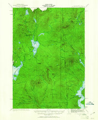
1927 Map of Second Lake
USGS Topo · Published 1961About this map
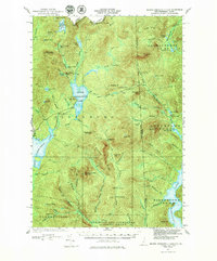
Second Lake and the upper reaches of the Connecticut River dominate this 1927 survey of the northern New Hampshire wilderness. The landscape is defined by its industrial and recreational outposts, from the remote Idlewild settlement to numerous logging and sporting camps like Camp No 36 and Depot Camp. Water management is evident at the Schoppe Dam on the Connecticut River, situated near the rugged Black Cat Spur. This period of the late 1920s shows the region's transition into a managed timber and watershed resource, with fire lookouts at Deer Mtn and Magalloway Mtn standing watch over the vast drainage basins of the Magalloway River and the First Connecticut Lake. The map meticulously tracks the international boundary with Quebec, noting landmarks such as United Salmon Mtn along the border with Canada.
Find a feature on this map
88 named features on this map. Tap any name to fly to it.
Don’t see what you’re looking for? This feature index may not catch every label — zoom into the map to look around manually.
Map Details
Editions of this 1927 Second Lake Map
6 editions found
Other maps of this area

1925 · Indian Stream
USGS Topo · 1:48,000

1926 · Indian Stream
USGS Topo · 1:62,500

1927 · Indian Stream
USGS Topo · 1:62,500

1927 · Moose Bog
USGS Topo · 1:48,000

1927 · Second Lake
USGS Topo · 1:62,500

1930 · Dixville
USGS Topo · 1:62,500

1930 · Errol
USGS Topo · 1:62,500

1931 · Cupsuptic
USGS Topo · 1:48,000

1931 · Moose Bog
USGS Topo · 1:62,500

1932 · Second Lake
USGS Topo · 1:62,500
Featured Places
- Pittsburg, NH
- Clarksville, NH
- Atkinson and Gilmanton Academy Grant, NH
- Parmachenee Township, ME
- Lynchtown Township, ME