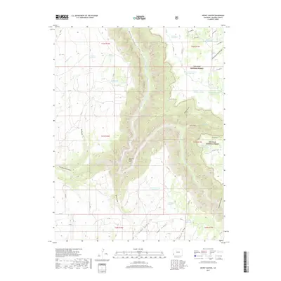
2019 Map of Secret Canyon
USGS Topo · Published 2019About this map
The Dolores River carves a deep, winding path through the heart of this landscape, creating the dramatic Dolores Canyon and isolating high plateaus like Mountain Sheep Point. This 2019 survey documents a complex network of water management features essential for high-altitude ranching and land use, including the Big Water Reservoir Number One and numerous numbered basins scattered across the San Juan National Forest.
Find a feature on this map
48 named features on this map. Tap any name to fly to it.
Don’t see what you’re looking for? This feature index may not catch every label — zoom into the map to look around manually.
Map Details
Editions of this 2019 Secret Canyon Map
This is the sole edition of this map. No revisions or reprints were ever made.
Other maps of this area

1949 · Egnar
USGS Topo · 1:24,000

1949 · Joe Davis Hill
USGS Topo · 1:24,000

1950 · Joe Davis Hill
USGS Topo · 1:24,000

1950 · Egnar
USGS Topo · 1:24,000

1956 · Cortez
USGS Topo · 1:250,000

1957 · Cedar 3 NW
USGS Topo · 1:24,000

1958 · Cortez
USGS Topo · 1:250,000

1959 · Cortez
USGS Topo · 1:250,000

1962 · Cortez
USGS Topo · 1:250,000
1964 · Dawson Draw
USGS Topo · 1:24,000