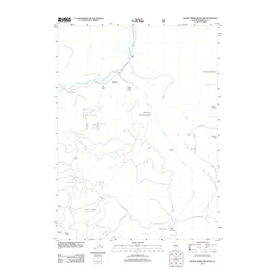
2012 Map of Secret Spring Mountain
USGS Topo · Published 2012About this map
The Klamath River flows through this corner of Siskiyou County, anchoring a landscape where riparian life meets steep canyon terrain. In the vicinity of Beswick, the river is joined by Shovel Cr and Edge Cr, with the notable Klamath Hot Springs situated along the bank. This area preserves traces of earlier rural development, including the Oak Grove School and established holdings like Hessig Ranch and Spannaus Ranch. The topography rises sharply away from the water toward Secret Spring Mountain and McGavin Peak, dissected by deep features such as Negro Creek Canyon and Flume Canyon. A network of Forest Service roads, including Schoolhouse Hill Rd and Poison Spring Rd, provides access to landmarks like the Bear Canyon Campground and the traditional points of the Lower Crossing and Upper Crossing on Shovel Creek.
Find a feature on this map
36 named features on this map. Tap any name to fly to it.
Don’t see what you’re looking for? This feature index may not catch every label — zoom into the map to look around manually.
Map Details
Editions of this 2012 Secret Spring Mountain Map
This is the sole edition of this map. No revisions or reprints were ever made.
Other maps of this area

1886 · Shasta
USGS Topo · 1:250,000

1891 · Ashland
USGS Topo · 1:250,000

1893 · Ashland
USGS Topo · 1:250,000

1894 · Shasta
USGS Topo · 1:250,000

1897 · Ashland
USGS Topo · 1:250,000

1934 · Macdoel
USGS Topo · 1:96,000

1941 · Macdoel
USGS Topo · 1:125,000

1948 · Weed
USGS Topo · 1:250,000

1950 · Weed
USGS Topo · 1:250,000

1954 · Macdoel
USGS Topo · 1:62,500