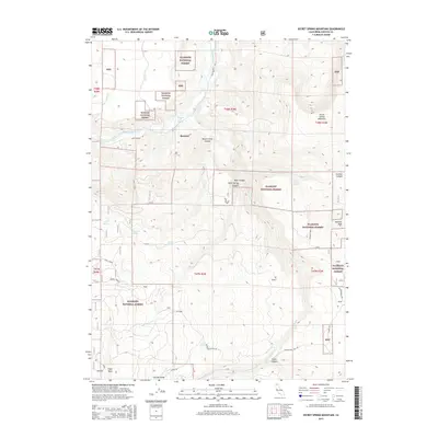
2015 Map of Secret Spring Mountain
USGS Topo · Published 2015About this map
Klamath Hot Springs and the settlement of Beswick lie along the northern reaches of the Klamath River, occupying a landscape defined by deep canyons and prominent volcanic peaks. Much of the region is protected as part of the Klamath National Forest, where the terrain rises sharply toward Secret Spring Mountain and McGavin Peak. The hydrology of this high-elevation area is marked by numerous named water sources, including Spannaus Spring, Lucky Spring, and Jewel Spring, which serve as vital points in the arid drainages. Early infrastructure is visible through routes like Ager Beswick Rd and Schoolhouse Hill Rd, reflecting a history of movement through Negro Creek Canyon and across Garvey Glade. Near the southern border, landmarks like Eagle Rock and the steep Flume Canyon emphasize the verticality of this Siskiyou County territory.
Find a feature on this map
36 named features on this map. Tap any name to fly to it.
Don’t see what you’re looking for? This feature index may not catch every label — zoom into the map to look around manually.
Map Details
Editions of this 2015 Secret Spring Mountain Map
This is the sole edition of this map. No revisions or reprints were ever made.
Other maps of this area

1886 · Shasta
USGS Topo · 1:250,000

1891 · Ashland
USGS Topo · 1:250,000

1893 · Ashland
USGS Topo · 1:250,000

1894 · Shasta
USGS Topo · 1:250,000

1897 · Ashland
USGS Topo · 1:250,000

1934 · Macdoel
USGS Topo · 1:96,000

1941 · Macdoel
USGS Topo · 1:125,000

1948 · Weed
USGS Topo · 1:250,000

1950 · Weed
USGS Topo · 1:250,000

1954 · Macdoel
USGS Topo · 1:62,500