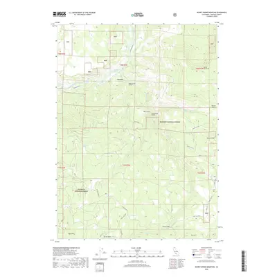
2018 Map of Secret Spring Mountain
USGS Topo · Published 2018About this map
The Beswick settlement sits along the Klamath River in a landscape defined by deep canyons and high mountain summits. This portion of the Klamath National Forest is rich with geothermal and hydrological features, notably Klamath Hot Springs and numerous named water sources like Spannaus Spring, Jewel Spring, and Poison Springs. The terrain rises sharply from the riverbank toward prominent landmarks such as McGavin Peak, Secret Spring Mountain, and Eagle Rock.
Find a feature on this map
76 named features on this map. Tap any name to fly to it.
Don’t see what you’re looking for? This feature index may not catch every label — zoom into the map to look around manually.
Map Details
Editions of this 2018 Secret Spring Mountain Map
This is the sole edition of this map. No revisions or reprints were ever made.
Other maps of this area

1886 · Shasta
USGS Topo · 1:250,000

1891 · Ashland
USGS Topo · 1:250,000

1893 · Ashland
USGS Topo · 1:250,000

1894 · Shasta
USGS Topo · 1:250,000

1897 · Ashland
USGS Topo · 1:250,000

1934 · Macdoel
USGS Topo · 1:96,000

1941 · Macdoel
USGS Topo · 1:125,000

1948 · Weed
USGS Topo · 1:250,000

1950 · Weed
USGS Topo · 1:250,000

1954 · Macdoel
USGS Topo · 1:62,500