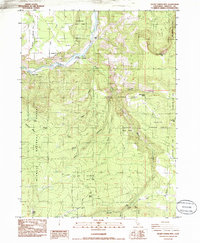
1985 Map of Secret Spring Mtn
USGS Topo · Published 1985About this map
Beswick and the therapeutic waters of Klamath Hot Springs anchor this mid-1980s study of Siskiyou County, where the Klamath River carves through the volcanic landscape of the Klamath National Forest. The map documents a rugged interior dominated by steep drainages like Shovel Creek and Panther Creek, revealing a landscape shaped by both natural features and human industry. Local ranching history is visible at the Hessig Ranch and Spannaus Ranch, while the inclusion of the Shovel Creek Flume Canyon points to historic water management systems in this mountainous region.
Find a feature on this map
24 named features on this map. Tap any name to fly to it.
Don’t see what you’re looking for? This feature index may not catch every label — zoom into the map to look around manually.
Map Details
Editions of this 1985 Secret Spring Mtn Map
This is the sole edition of this map. No revisions or reprints were ever made.
Other maps of this area

1886 · Shasta
USGS Topo · 1:250,000

1891 · Ashland
USGS Topo · 1:250,000

1893 · Ashland
USGS Topo · 1:250,000

1894 · Shasta
USGS Topo · 1:250,000

1897 · Ashland
USGS Topo · 1:250,000

1934 · Macdoel
USGS Topo · 1:96,000

1941 · Macdoel
USGS Topo · 1:125,000

1948 · Weed
USGS Topo · 1:250,000

1950 · Weed
USGS Topo · 1:250,000

1954 · Macdoel
USGS Topo · 1:62,500