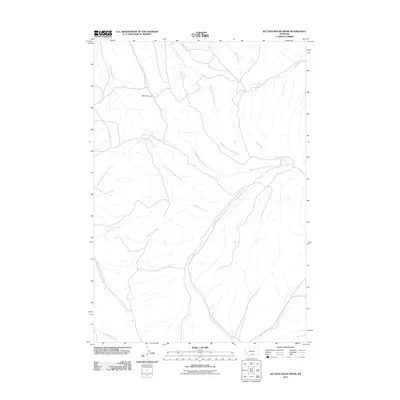
2011 Map of Section House Draw
USGS Topo · Published 2011About this map
Black Canyon serves as a central landmark in this high-plains landscape within Carbon County, Montana. The drainage patterns here reveal a complex network of waterways, where the Middle Fork Fivemile Creek and North Fork Fivemile Creek converge as they navigate the arid terrain. The map details a transition from the narrow draws of the uplands to broader valleys, punctuated by isolated features such as Sand Spring in the northeast.
Find a feature on this map
12 named features on this map. Tap any name to fly to it.
Don’t see what you’re looking for? This feature index may not catch every label — zoom into the map to look around manually.
Map Details
Editions of this 2011 Section House Draw Map
This is the sole edition of this map. No revisions or reprints were ever made.
Other maps of this area

1954 · Billings
USGS Topo · 1:250,000

1956 · Edgar
USGS Topo · 1:24,000

1957 · Billings
USGS Topo · 1:250,000

1958 · Billings
USGS Topo · 1:250,000

1967 · Castle Rocks
USGS Topo · 1:24,000

1967 · Pryor
USGS Topo · 1:24,000

1967 · Section House Draw
USGS Topo · 1:24,000

1967 · Bluewater
USGS Topo · 1:24,000
1967 · Pryor NW
USGS Topo · 1:24,000

1969 · Bowler
USGS Topo · 1:24,000