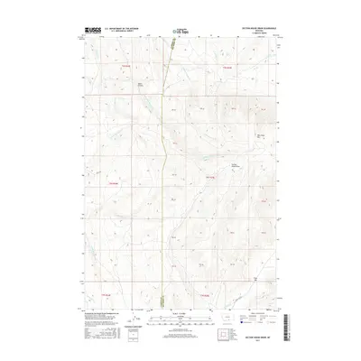
2017 Map of Section House Draw
USGS Topo · Published 2017About this map
West Pryor Mtn anchors this terrain in southern Montana, where the boundary between Carbon and Big Horn counties cuts through a complex system of drainage and relief. The landscape is defined by the deep incisions of Black Canyon and Section House Draw, reflecting the geological character of the Pryor Mountains. Seasonal and perennial water sources like Sand Spring and Bird Spring provided critical watering points for early travel through this arid region. The drainage network is particularly dense, with the N Fork, Middle Fork, and original Fivemile Cr converging to the west, while Bluewater Cr and its southern fork dominate the central reaches. A primary passage through the high country is marked by the Pryor Gap, a distinctive natural break in the mountain topography utilized by Pryor Gap Rd.
Find a feature on this map
37 named features on this map. Tap any name to fly to it.
Don’t see what you’re looking for? This feature index may not catch every label — zoom into the map to look around manually.
Map Details
Editions of this 2017 Section House Draw Map
This is the sole edition of this map. No revisions or reprints were ever made.
Other maps of this area

1954 · Billings
USGS Topo · 1:250,000

1956 · Edgar
USGS Topo · 1:24,000

1957 · Billings
USGS Topo · 1:250,000

1958 · Billings
USGS Topo · 1:250,000

1967 · Castle Rocks
USGS Topo · 1:24,000

1967 · Pryor
USGS Topo · 1:24,000

1967 · Section House Draw
USGS Topo · 1:24,000

1967 · Bluewater
USGS Topo · 1:24,000
1967 · Pryor NW
USGS Topo · 1:24,000

1969 · Bowler
USGS Topo · 1:24,000