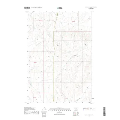
2020 Map of Section House Draw
USGS Topo · Published 2020About this map
West Pryor Mtn dominates the eastern elevation of this landscape on the border of Carbon and Big Horn counties. The topography is defined by sharp vertical relief and a complex network of drainages, including the prominent Section House Draw and the deep incision of Black Canyon. Water sources are critical in this high-altitude environment, marked by isolated points like Sand Spring and Bird Spring, which feed into various branches of Fivemile Cr and Bluewater Cr.
Find a feature on this map
24 named features on this map. Tap any name to fly to it.
Don’t see what you’re looking for? This feature index may not catch every label — zoom into the map to look around manually.
Map Details
Editions of this 2020 Section House Draw Map
This is the sole edition of this map. No revisions or reprints were ever made.
Other maps of this area

1954 · Billings
USGS Topo · 1:250,000

1956 · Edgar
USGS Topo · 1:24,000

1957 · Billings
USGS Topo · 1:250,000

1958 · Billings
USGS Topo · 1:250,000

1967 · Castle Rocks
USGS Topo · 1:24,000

1967 · Pryor
USGS Topo · 1:24,000

1967 · Section House Draw
USGS Topo · 1:24,000

1967 · Bluewater
USGS Topo · 1:24,000
1967 · Pryor NW
USGS Topo · 1:24,000

1969 · Bowler
USGS Topo · 1:24,000