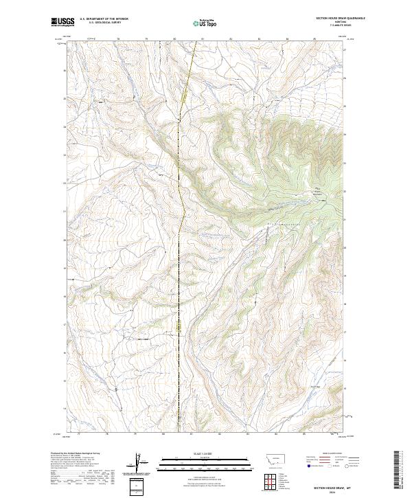
2024 Map of Section House Draw
USGS Topo · Published 2024About this map
West Pryor Mountain and the surrounding Pryor Mountains dominate this high-desert landscape on the border of Carbon and Big Horn counties. The terrain is defined by deep incisions like Black Canyon and the namesake Section House Draw, a geographic feature that reflects the historic rail-and-trail infrastructure once required to navigate these passes. Water sources are critical here, with named points like Sand Spring and Bird Spring serving as vital markers in an otherwise arid environment. Along the southern edge, the terrain drops toward Pryor Gap, a traditional mountain passage where Summit Creek and Pryor Gap Rd follow the natural contours of the land. The map also records numerous survey tracts and the winding courses of Fivemile Creek and Bluewater Creek, illustrating how the drainage patterns dictate the placement of ranch roads like Lester Rd.
Find a feature on this map
40 named features on this map. Tap any name to fly to it.
Don’t see what you’re looking for? This feature index may not catch every label — zoom into the map to look around manually.
Map Details
Editions of this 2024 Section House Draw Map
This is the sole edition of this map. No revisions or reprints were ever made.
Other maps of this area

1954 · Billings
USGS Topo · 1:250,000

1956 · Edgar
USGS Topo · 1:24,000

1957 · Billings
USGS Topo · 1:250,000

1958 · Billings
USGS Topo · 1:250,000

1967 · Castle Rocks
USGS Topo · 1:24,000

1967 · Pryor
USGS Topo · 1:24,000

1967 · Section House Draw
USGS Topo · 1:24,000

1967 · Bluewater
USGS Topo · 1:24,000
1967 · Pryor NW
USGS Topo · 1:24,000

1969 · Bowler
USGS Topo · 1:24,000