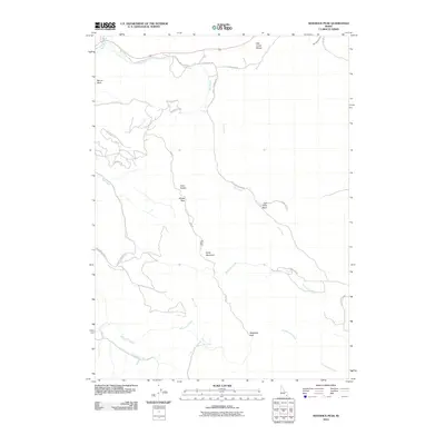
2010 Map of Sedgwick Peak
USGS Topo · Published 2010About this map
Sedgwick Peak and the Fish Creek Range dominate this high-altitude landscape in Southeast Idaho, where the peaks of the northern Rockies overlook a network of high basins and creek drainages. The topography is defined by significant elevations, including Baldy Mountain and Mount Moh, which rise above the surrounding valleys. A notable point of historical interest is the Lead Bell Mine, situated near Windy Pass along Road W, signifying the area's history of mineral exploration. The drainage pattern is complex, with Fish Creek and East Creek carving through the terrain, while the Portneuf River clips the northern corner of the quadrangle. Transport in this period is largely restricted to backcountry routes like Baldy Mountain Rd and the Grace Cutoff, indicating a region primarily used for resource extraction and land management rather than dense settlement.
Find a feature on this map
30 named features on this map. Tap any name to fly to it.
Don’t see what you’re looking for? This feature index may not catch every label — zoom into the map to look around manually.
Map Details
Editions of this 2010 Sedgwick Peak Map
This is the sole edition of this map. No revisions or reprints were ever made.
Other maps of this area

1915 · Preston
USGS Topo · 1:96,000

1918 · Preston
USGS Topo · 1:125,000

1948 · Bancroft
USGS Topo · 1:62,500

1949 · Bancroft
USGS Topo · 1:62,500

1954 · Pocatello
USGS Topo · 1:250,000

1955 · Preston
USGS Topo · 1:250,000

1958 · Pocatello
USGS Topo · 1:250,000

1958 · Preston
USGS Topo · 1:250,000

1962 · Preston
USGS Topo · 1:250,000
1968 · Downey East
USGS Topo · 1:24,000