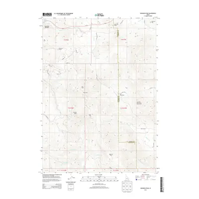
2013 Map of Sedgwick Peak
USGS Topo · Published 2013About this map
Lava Hot Springs and the surrounding high country of the Portneuf Range define this portion of Southeast Idaho. The landscape is a complex intersection of geologic boundaries, most notably the Columbia River Great Basin Divide which bisects the eastern half of the quadrangle. The terrain rises sharply from the Portneuf River valley toward prominent elevations like Sedgwick Peak and Baldy Mtn, with smaller water features such as Upper Spring and Fish Cr draining the diverse topography.
Find a feature on this map
45 named features on this map. Tap any name to fly to it.
Don’t see what you’re looking for? This feature index may not catch every label — zoom into the map to look around manually.
Map Details
Editions of this 2013 Sedgwick Peak Map
This is the sole edition of this map. No revisions or reprints were ever made.
Other maps of this area

1915 · Preston
USGS Topo · 1:96,000

1918 · Preston
USGS Topo · 1:125,000

1948 · Bancroft
USGS Topo · 1:62,500

1949 · Bancroft
USGS Topo · 1:62,500

1954 · Pocatello
USGS Topo · 1:250,000

1955 · Preston
USGS Topo · 1:250,000

1958 · Pocatello
USGS Topo · 1:250,000

1958 · Preston
USGS Topo · 1:250,000

1962 · Preston
USGS Topo · 1:250,000
1968 · Downey East
USGS Topo · 1:24,000