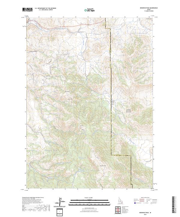
2023 Map of Sedgwick Peak
USGS Topo · Published 2023About this map
Sedgwick Peak rises as a central landmark in this high-elevation landscape where the Fish Creek Range and the Portneuf Range meet. This terrain is defined by the Columbia River Great Basin Divide, a critical hydrological boundary separating the vast drainage systems of the interior West. The map reveals a network of mountain roads and tracks, such as Old Fish Creek Rd and Potter Rd, which navigate around prominent summits like Baldy Mtn and through named passes including Windy Pass. Drainage patterns are clearly marked by the paths of Fish Creek, Densmore Creek, and Cottonwood Creek, illustrating how water moves through high-country features like Fish Creek Basin and Henderson Canyon. The presence of numerous named peaks and ridges, such as Twin Knobs, highlights the topographical complexity of this portion of Idaho.
Find a feature on this map
41 named features on this map. Tap any name to fly to it.
Don’t see what you’re looking for? This feature index may not catch every label — zoom into the map to look around manually.
Map Details
Editions of this 2023 Sedgwick Peak Map
This is the sole edition of this map. No revisions or reprints were ever made.
Other maps of this area

1915 · Preston
USGS Topo · 1:96,000

1918 · Preston
USGS Topo · 1:125,000

1948 · Bancroft
USGS Topo · 1:62,500

1949 · Bancroft
USGS Topo · 1:62,500

1954 · Pocatello
USGS Topo · 1:250,000

1955 · Preston
USGS Topo · 1:250,000

1958 · Pocatello
USGS Topo · 1:250,000

1958 · Preston
USGS Topo · 1:250,000

1962 · Preston
USGS Topo · 1:250,000
1968 · Downey East
USGS Topo · 1:24,000