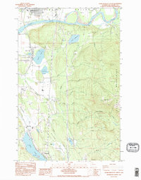
1985 Map of Sedro-Woolley South
USGS Topo · Published 1995About this map
Sedro-Woolley anchors the northern edge of this Skagit County landscape, where the Skagit River meanders through a valley filled with significant fluvial features like Skiyou Island and Ross Island. The transition from the fertile Skagit Valley to the rising timberlands of the Cultus Mountains is marked by a series of lakes and timber-industry remnants. South of the main river, a network of water bodies including Clear Lake, Beaver Lake, and the expansive Big Lake provided the foundation for local settlements like Montborne and Turner. Industrial activity is evident through the presence of a Quarry and Gravel Pit in Walker Valley, alongside infrastructure such as a Compressor Station and an Old RR Grade. These features trace the historical reliance on both the river system and terrestrial resource extraction that defined this region's mid-to-late 20th-century development.
Find a feature on this map
40 named features on this map. Tap any name to fly to it.
Don’t see what you’re looking for? This feature index may not catch every label — zoom into the map to look around manually.
Map Details
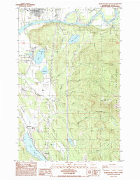
Editions of this 1985 Sedro-Woolley South Map
2 editions found
Other maps of this area

1911 · Mount Vernon
USGS Topo · 1:125,000

1918 · Samish Lake
USGS Topo · 1:62,500

1921 · Wickersham
USGS Topo · 1:62,500

1940 · Mt Vernon
USGS Topo · 1:62,500

1943 · Mt Vernon
USGS Topo · 1:62,500

1944 · Clear Lake
USGS Topo · 1:62,500

1951 · Wickersham
USGS Topo · 1:62,500

1952 · Alger
USGS Topo · 1:24,000

1954 · Samish Lake
USGS Topo · 1:62,500
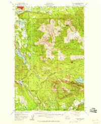
1956 · Clear Lake
USGS Topo · 1:62,500