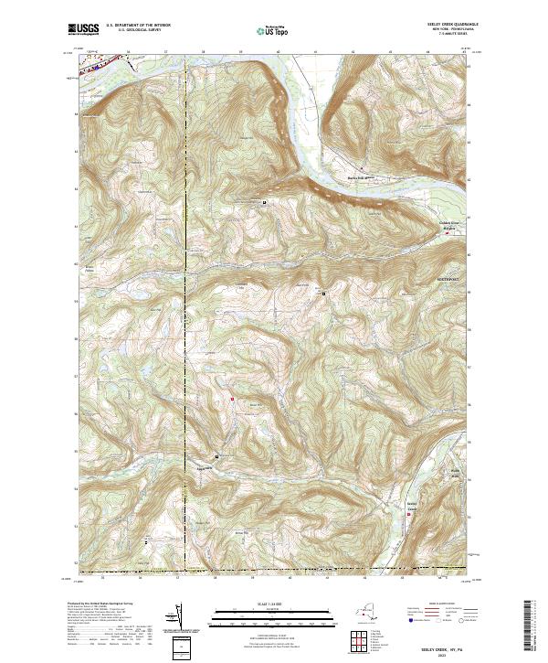
2023 Map of Seeley Creek
USGS Topo · Published 2023About this map
The Mount Saviour Monastery sits at the high center of this landscape, overlooking the sweeping bend of the Chemung River as it cuts between Steege Hill and Leach Hill. This region is defined by prominent elevations and narrow valley drainages, where small rural settlements like Sagetown and Webb Mills are tucked away along the watercourses. Local genealogy is well-documented through several family-named burial sites, including the Sagetown Cem and Kelly Hill Cem.
Find a feature on this map
97 named features on this map. Tap any name to fly to it.
Don’t see what you’re looking for? This feature index may not catch every label — zoom into the map to look around manually.
Map Details
Editions of this 2023 Seeley Creek Map
This is the sole edition of this map. No revisions or reprints were ever made.
Other maps of this area

1895 · Elmira
USGS Topo · 1:62,500

1900 · Tioga
USGS Topo · 1:62,500

1902 · Tioga
USGS Topo · 1:62,500

1905 · Watkins Glen
USGS Topo · 1:125,000

1914 · Corning
USGS Topo · 1:62,500

1931 · Troy
USGS Topo · 1:48,000

1938 · Troy
USGS Topo · 1:62,500

1944 · Corning
USGS Topo · 1:62,500

1950 · Elmira
USGS Topo · 1:250,000
1953 · Corning
USGS Topo · 1:24,000