
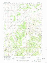
1957 Map of Seely
USGS Topo · Published 1959About this map
The Little Missouri River and its upper tributaries dominate this ranching landscape along the border between Wyoming and Montana. In the late 1950s, the rural community of Seely served as a central point for a network of family-owned homesteads, including the Ackerman Ranch, Jolley Ranch, and Dewitt Ranch. The map reveals a frontier economy where livestock ranching and natural resource extraction coincided, evidenced by several Clay Pits and a Gravel Pit scattered across the drainages.
Find a feature on this map
57 named features on this map. Tap any name to fly to it.
Don’t see what you’re looking for? This feature index may not catch every label — zoom into the map to look around manually.
Map Details
Editions of this 1957 Seely Map
2 editions found
Other maps of this area

1901 · Aladdin
USGS Topo · 1:125,000

1903 · Aladdin
USGS Topo · 1:125,000

1905 · Devils Tower
USGS Topo · 1:125,000

1954 · Strawberry Hill
USGS Topo · 1:24,000

1954 · Storm Hill
USGS Topo · 1:24,000

1954 · Ekalaka
USGS Topo · 1:250,000

1954 · Gillette
USGS Topo · 1:250,000

1955 · Devils Tower
USGS Topo · 1:62,500

1955 · Gillette
USGS Topo · 1:250,000

1956 · Ekalaka
USGS Topo · 1:250,000