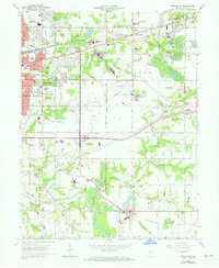
1963 Map of Seelyville
USGS Topo · Published 1973About this map
Seelyville and the eastern edge of Terre Haute anchor this landscape, where the transition from city blocks to rural townships is defined by heavy industry and infrastructure. The industrial heritage is evident in the Mt Pleasant Mine and scattered Oil Wells, while the presence of the Wabash and Erie Canal traces an earlier era of transport now superseded by the Penn Central and the Milwaukee Road railways. Educational and military landmarks are prominent, including the Rose-Hulman Institute of Technology and the Hulman Airport, which serves as a base for the Indiana Air National Guard. Moving south, the terrain opens into farming and smaller settlements like Riley, marked by numerous country churches and family burial grounds such as Mewhinney Cem and Cooper Cem. The drainage of Honey Creek and Lost Creek dictates much of the local topography outside the developed corridor of the National Road.
Find a feature on this map
56 named features on this map. Tap any name to fly to it.
Don’t see what you’re looking for? This feature index may not catch every label — zoom into the map to look around manually.
Map Details
Editions of this 1963 Seelyville Map
4 editions found
Other maps of this area

1908 · Clay City
USGS Topo · 1:48,000

1910 · Clay City
USGS Topo · 1:62,500

1940 · Lewis
USGS Topo · 1:24,000

1940 · Pimento
USGS Topo · 1:24,000

1941 · Seelyville
USGS Topo · 1:24,000

1941 · Terre Haute
USGS Topo · 1:24,000

1948 · Terre Haute
USGS Topo · 1:24,000

1950 · Rosedale
USGS Topo · 1:24,000

1950 · Brazil West
USGS Topo · 1:24,000

1950 · New Goshen
USGS Topo · 1:24,000