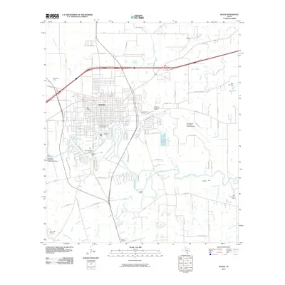
2010 Map of Seguin
USGS Topo · Published 2010About this map
The Guadalupe River carves a deep bend through the heart of the landscape, anchoring the development of Seguin and its surrounding Guadalupe County countryside. This 2010 survey highlights the Seguin Commercial Historic District as the urban core, while the river's flow is managed by a series of structures including Max Starcke Dam, Saffold Dam, and the Nolte Dam. The map documents a significant aviation presence in the region, featuring Randolph Air Force Base Auxiliary Airport, Joe Fleming Field, and Elm Creek Airpark.
Find a feature on this map
91 named features on this map. Tap any name to fly to it.
Don’t see what you’re looking for? This feature index may not catch every label — zoom into the map to look around manually.
Map Details
Editions of this 2010 Seguin Map
This is the sole edition of this map. No revisions or reprints were ever made.
Other maps of this area

1911 · San Marcos
USGS Topo · 1:125,000

1919 · San Marcos
USGS Topo · 1:125,000

1920 · Smiley
USGS Topo · 1:125,000

1924 · New Braunfels No 4
USGS Topo · 1:48,000

1924 · San Marcos 3-c
USGS Topo · 1:48,000

1924 · San Marcos 3-d
USGS Topo · 1:48,000

1925 · New Braunfels No 1
USGS Topo · 1:48,000

1927 · New Braunfels
USGS Topo · 1:62,500

1930 · Seguin
USGS Topo · 1:62,500

1942 · Dewville
USGS Topo · 1:62,500