
1955 Map of Seiad Valley
USGS Topo · Published 1957About this map
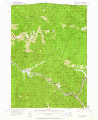
Seiad Valley sits at the confluence of Seiad Creek and the Klamath River, serving as a central hub for this mid-1950s survey of the California-Oregon borderlands. The landscape is defined by its deep mining and ranching roots, evidenced by the Dredge Tailings along the river and the presence of the Ladd Mine and Blue Ledge Mine. Remote outposts like Hutton GS and Ranger Sta indicate the active forest management within the Rogue River National Forest and Siskiyou National Forest. Transportation is primarily limited to river-hugging roads and a Jeep Trail winding through the high ridges. Along the river, small riverside communities like Hamburg and Steelhead highlight the era's local economy, while several remote camps including Cook and Green Campground and Totten Campground suggest the region's long-standing role as a destination for outdoor recreation.
Find a feature on this map
92 named features on this map. Tap any name to fly to it.
Don’t see what you’re looking for? This feature index may not catch every label — zoom into the map to look around manually.
Map Details
Editions of this 1955 Seiad Valley Map
3 editions found
Other maps of this area

1886 · Shasta
USGS Topo · 1:250,000

1891 · Ashland
USGS Topo · 1:250,000

1893 · Ashland
USGS Topo · 1:250,000

1894 · Shasta
USGS Topo · 1:250,000

1897 · Ashland
USGS Topo · 1:250,000

1908 · Grants Pass
USGS Topo · 1:125,000

1914 · Seiad
USGS Topo · 1:125,000

1922 · Seiad
USGS Topo · 1:125,000

1932 · Yreka
USGS Topo · 1:96,000

1938 · Medford
USGS Topo · 1:125,000