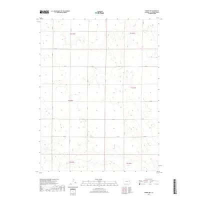
2019 Map of Seibert NW
USGS Topo · Published 2019About this map
Hell Cr and Buffalo Cr define the drainage patterns of this high plains landscape in Kit Carson County. The map reveals the rigid precision of the Public Land Survey System, with roads like Co Rd 9 and Co Rd 14 following section lines to create a sprawling grid across townships such as t7s r50w and t6s r49w. This geometry illustrates the enduring impact of homestead-era land division on modern Colorado agriculture and transport.
Find a feature on this map
19 named features on this map. Tap any name to fly to it.
Don’t see what you’re looking for? This feature index may not catch every label — zoom into the map to look around manually.
Map Details
Editions of this 2019 Seibert NW Map
This is the sole edition of this map. No revisions or reprints were ever made.
Other maps of this area

1954 · Limon
USGS Topo · 1:250,000

1957 · Limon
USGS Topo · 1:250,000

1958 · Limon
USGS Topo · 1:250,000

1977 · Cope SE
USGS Topo · 1:24,000

1977 · Anton SE
USGS Topo · 1:24,000

1977 · Cope SW
USGS Topo · 1:24,000

1979 · Seibert NE
USGS Topo · 1:24,000

1979 · Flagler
USGS Topo · 1:24,000
1979 · Flagler NE
USGS Topo · 1:24,000
1979 · Seibert NW
USGS Topo · 1:24,000