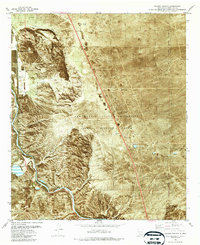
1982 Map of Selden Canyon
USGS Topo · Published 1987About this map
Tonuco Mountain and the surrounding desert of Doña Ana County are defined by the winding course of the Rio Grande and the critical transportation corridor of the Atchison Topeka and Santa Fe railroad. This early 1980s orthophotomap provides a clear view of the Rincon Valley area, including the small settlements of Tonuco and Foster. The landscape is heavily influenced by agricultural and research activities, notably the extensive New Mexico State University Animal Science Ranch which occupies a large portion of the eastern desert.
Find a feature on this map
26 named features on this map. Tap any name to fly to it.
Don’t see what you’re looking for? This feature index may not catch every label — zoom into the map to look around manually.
Map Details
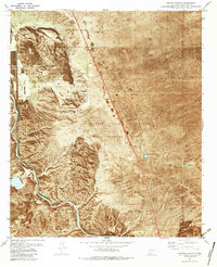
Editions of this 1982 Selden Canyon Map
2 editions found
Other maps of this area

1891 · Las Cruces
USGS Topo · 1:125,000

1893 · Las Cruces
USGS Topo · 1:125,000

1916 · Tonuco
USGS Topo · 1:125,000

1932 · Tonuco
USGS Topo · 1:125,000

1941 · Las Cruces
USGS Topo · 1:62,500

1943 · Corralitos Ranch
USGS Topo · 1:62,500

1943 · Las Cruces
USGS Topo · 1:62,500

1948 · San Diego Mountain
USGS Topo · 1:62,500

1955 · Las Cruces
USGS Topo · 1:250,000

1958 · Las Cruces
USGS Topo · 1:250,000