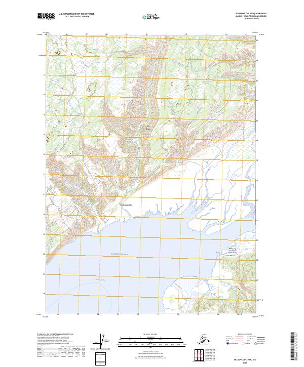
2024 Map of Seldovia D-3 SW
USGS Topo · Published 2024About this map
Kachemak Silo serves as a primary reference point along the northern shores of Kachemak Bay, where the drainage of the Fox River meets the tide. This coastal landscape is defined by the convergence of numerous glacial-fed waterways, including Moose Creek, Fox Creek, and Swift Creek, which carve through the terrain before reaching the Pacific Ocean. The local road network, featuring names like Murmansk Road, Basargin Road, and Voznesenka Road, suggests a history of settlement and connectivity at the eastern terminus of East End Road. On the southeastern edge of the bay, the Bradley Lake Hydroelectric Project Airstrip indicates industrial activity near the mouths of Battle Creek and the Martin River, highlighting the intersection of remote Alaskan wilderness and modern infrastructure.
Find a feature on this map
23 named features on this map. Tap any name to fly to it.
Don’t see what you’re looking for? This feature index may not catch every label — zoom into the map to look around manually.
Map Details
Editions of this 2024 Seldovia D-3 SW Map
This is the sole edition of this map. No revisions or reprints were ever made.
Other maps of this area

1948 · Seldovia C-4
USGS Topo · 1:63,360

1949 · Seldovia C-4
USGS Topo · 1:62,500

1949 · Seldovia D-4
USGS Topo · 1:63,360

1951 · Seldovia D-4
USGS Topo · 1:63,360

1951 · Seldovia
USGS Topo · 1:250,000

1951 · Seldovia D-3
USGS Topo · 1:63,360

1951 · Seldovia C-3
USGS Topo · 1:63,360

1953 · Seldovia C-3
USGS Topo · 1:63,360
1953 · Seldovia D-3
USGS Topo · 1:63,360
1961 · Seldovia C-4
USGS Topo · 1:63,360