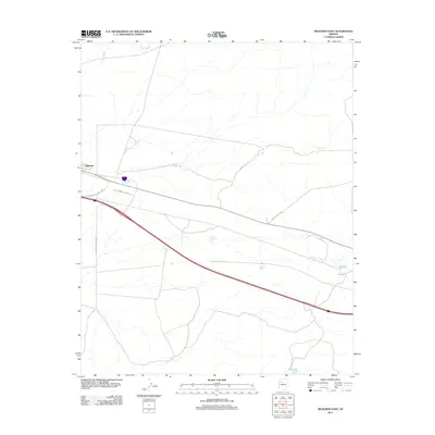
2011 Map of Seligman East
USGS Topo · Published 2011About this map
Seligman serves as the focal point for this landscape in the western reaches of the state, where the infrastructure of transportation and water management defines local life. The area is characterized by an extensive network of water collection points essential for ranching and survival in the high desert, including Padre Reservoir, Hoffman Tank, and the uniquely named Cedar Berry Bob Tank. These features are connected by a sparse grid of rural routes such as Campbell Ranch Rd and N Williamson Valley Rd. The northern drainage of Chino Wash provides a primary geographic boundary, while Seligman Cemetery Rd marks a site of local genealogical importance. This survey illustrates how human activity, from the central settlement to the outlying stock tanks like Maverick Tank, has adapted to the arid terrain through strategic engineering.
Find a feature on this map
16 named features on this map. Tap any name to fly to it.
Don’t see what you’re looking for? This feature index may not catch every label — zoom into the map to look around manually.
Map Details
Editions of this 2011 Seligman East Map
This is the sole edition of this map. No revisions or reprints were ever made.
Other maps of this area

1886 · Chino
USGS Topo · 1:250,000

1891 · Chino
USGS Topo · 1:250,000

1947 · Picacho Butte
USGS Topo · 1:62,500

1947 · Turkey Canyon
USGS Topo · 1:62,500

1948 · Williams
USGS Topo · 1:250,000

1948 · Picacho Butte
USGS Topo · 1:63,360

1950 · Turkey Canyon
USGS Topo · 1:62,500

1950 · Picacho Butte
USGS Topo · 1:62,500

1954 · Williams
USGS Topo · 1:250,000

1956 · Williams
USGS Topo · 1:250,000