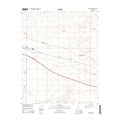
2014 Map of Seligman East
USGS Topo · Published 2014About this map
Seligman serves as the focal point of this northern Arizona survey, marking the transition from high plateau grasslands into the dramatic descent of Railroad Canyon. This landscape is defined by the evolution of American transport, where the path of Historic US-66 parallels the modern Interstate-40 corridor. The rugged terrain is etched by the drainage of Chino Wash and supported by a network of water catchments essential for ranching and rail operations, including Padre Reservoir and various named stock tanks like Wagner Tank and Sinkhole Tank. The county line between Coconino Co and Yavapai Co cuts diagonally across the northern section, highlighting the administrative boundaries of this vast ranching territory. Local infrastructure is further detailed by established routes such as Crookton Rd and Campbell Ranch Rd, providing a clear picture of the region's mid-2010s layout.
Find a feature on this map
31 named features on this map. Tap any name to fly to it.
Don’t see what you’re looking for? This feature index may not catch every label — zoom into the map to look around manually.
Map Details
Editions of this 2014 Seligman East Map
This is the sole edition of this map. No revisions or reprints were ever made.
Other maps of this area

1886 · Chino
USGS Topo · 1:250,000

1891 · Chino
USGS Topo · 1:250,000

1947 · Picacho Butte
USGS Topo · 1:62,500

1947 · Turkey Canyon
USGS Topo · 1:62,500

1948 · Williams
USGS Topo · 1:250,000

1948 · Picacho Butte
USGS Topo · 1:63,360

1950 · Turkey Canyon
USGS Topo · 1:62,500

1950 · Picacho Butte
USGS Topo · 1:62,500

1954 · Williams
USGS Topo · 1:250,000

1956 · Williams
USGS Topo · 1:250,000