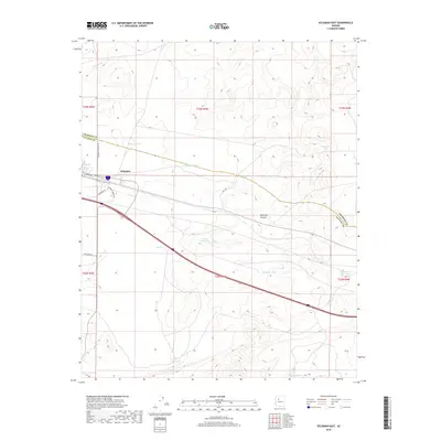
2018 Map of Seligman East
USGS Topo · Published 2018About this map
Seligman serves as the focal point for this high-desert landscape in the late 2010s, situated at the junction of local transit routes and historical infrastructure. The terrain is defined by the significant passage of Railroad Canyon, which snakes through the eastern half of the quadrangle. Water management is a central theme of this arid region, as evidenced by numerous named catchment features like Padre Reservoir and a series of livestock or resource tanks including Thirtysix Tank, Wagner Tank, and Hoffman Tank.
Find a feature on this map
25 named features on this map. Tap any name to fly to it.
Don’t see what you’re looking for? This feature index may not catch every label — zoom into the map to look around manually.
Map Details
Editions of this 2018 Seligman East Map
This is the sole edition of this map. No revisions or reprints were ever made.
Other maps of this area

1886 · Chino
USGS Topo · 1:250,000

1891 · Chino
USGS Topo · 1:250,000

1947 · Picacho Butte
USGS Topo · 1:62,500

1947 · Turkey Canyon
USGS Topo · 1:62,500

1948 · Williams
USGS Topo · 1:250,000

1948 · Picacho Butte
USGS Topo · 1:63,360

1950 · Turkey Canyon
USGS Topo · 1:62,500

1950 · Picacho Butte
USGS Topo · 1:62,500

1954 · Williams
USGS Topo · 1:250,000

1956 · Williams
USGS Topo · 1:250,000