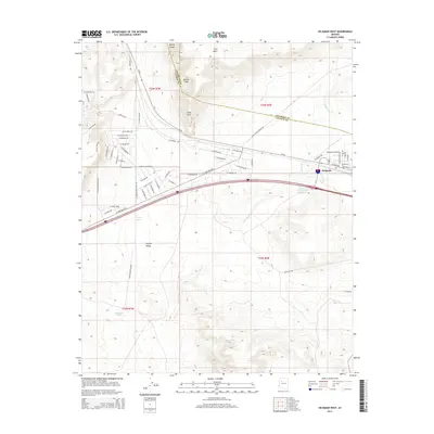
2014 Map of Seligman West
USGS Topo · Published 2014About this map
Seligman serves as the primary hub in this western Arizona landscape where the high plateau meets the drainage of the Chino Wash. Located along the historic corridor of Az-66, the settlement is framed by the striking verticality of the Aubrey Cliffs and the prominent rising form of Red Mesa. The map illustrates a transition from the structured residential grid in town to the sprawling geography of the Aubrey Valley to the south and west. Water management is a critical theme of the area's development, evidenced by features like the Railroad Embankment Reservoir and isolated watering points such as Shorty Tank and Quintanna Tank. The transportation network is dominated by the highway and the Seligman Airport, while the geological prominence of Chino Point marks the rugged break in the terrain where the cliffs overlook the valley floor.
Find a feature on this map
62 named features on this map. Tap any name to fly to it.
Don’t see what you’re looking for? This feature index may not catch every label — zoom into the map to look around manually.
Map Details
Editions of this 2014 Seligman West Map
This is the sole edition of this map. No revisions or reprints were ever made.
Other maps of this area

1886 · Diamond Creek
USGS Topo · 1:250,000

1886 · Chino
USGS Topo · 1:250,000

1891 · Chino
USGS Topo · 1:250,000

1892 · Diamond Creek
USGS Topo · 1:250,000

1947 · Turkey Canyon
USGS Topo · 1:62,500

1948 · Williams
USGS Topo · 1:250,000

1950 · Turkey Canyon
USGS Topo · 1:62,500

1954 · Williams
USGS Topo · 1:250,000

1956 · Williams
USGS Topo · 1:250,000

1960 · Williams
USGS Topo · 1:250,000