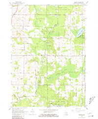
1965 Map of Selkirk
USGS Topo · Published 1981About this map
Aboriginal Earthworks are documented in multiple locations along the winding Rifle River corridor, pointing to an ancient human presence within the present-day Au Sable State Forest. By the mid-1960s, this area of Ogemaw County was defined by a mix of forestry and rural community life, anchored by the settlement of Selkirk. The landscape is dotted with several one-room schoolhouses and country churches, such as Red Sch, Withey Sch, and Churchill Ch, which served the scattered residents of Cumming and Churchill townships.
Find a feature on this map
61 named features on this map. Tap any name to fly to it.
Don’t see what you’re looking for? This feature index may not catch every label — zoom into the map to look around manually.
Map Details
Editions of this 1965 Selkirk Map
2 editions found
Other maps of this area

1954 · Traverse City
USGS Topo · 1:250,000

1954 · Tawas City
USGS Topo · 1:250,000

1958 · Traverse City
USGS Topo · 1:250,000

1958 · Tawas City
USGS Topo · 1:250,000

1965 · Damon
USGS Topo · 1:24,000

1965 · West Branch
USGS Topo · 1:24,000

1965 · Selkirk
USGS Topo · 1:24,000

1965 · Rose City
USGS Topo · 1:24,000

1968 · Prescott
USGS Topo · 1:24,000

1968 · Sage Lake
USGS Topo · 1:24,000