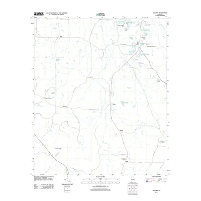
2011 Map of Sellers
USGS Topo · Published 2011About this map
Pintlala Creek winds through this rural Montgomery County landscape, defining a region where small hamlets and family-named lakes represent the primary centers of activity. The settlement pattern is anchored by the community of Sellers, with several smaller locales like Fleta, Naftel, and Ada scattered across the township. For genealogists, the inclusion of the Fair Prospect Cemetery and Bell Cemetery provides specific points for local research.
Find a feature on this map
72 named features on this map. Tap any name to fly to it.
Don’t see what you’re looking for? This feature index may not catch every label — zoom into the map to look around manually.
Map Details
Editions of this 2011 Sellers Map
This is the sole edition of this map. No revisions or reprints were ever made.
Other maps of this area

1953 · Montgomery
USGS Topo · 1:250,000

1953 · Andalusia
USGS Topo · 1:250,000

1956 · Montgomery
USGS Topo · 1:250,000

1957 · Montgomery
USGS Topo · 1:250,000

1957 · Andalusia
USGS Topo · 1:250,000

1957 · Letohatchee
USGS Topo · 1:62,500

1968 · Grady
USGS Topo · 1:24,000

1971 · Danielsville
USGS Topo · 1:24,000

1971 · Davis Crossroads
USGS Topo · 1:24,000
1971 · Ramer
USGS Topo · 1:24,000