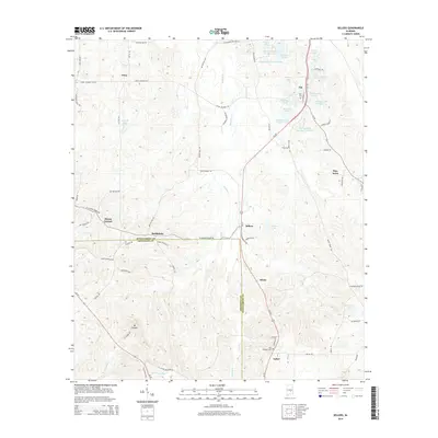
2014 Map of Sellers
USGS Topo · Published 2014About this map
Pintlala Cr winds through the heart of this Central Alabama landscape, defining the rural character of the border between Montgomery and Crenshaw counties. Small, historically distinct settlements like Fleta, Ada, Sellers, and Strata follow the path of Us-331, which serves as the primary corridor for this agricultural and timber region. The map reveals a high concentration of private impoundments and small lakes, including Skywood Lake Number One, Cauthen Pond, and the Montgomery Hunting Club Lake, illustrating a shift in land use toward recreation and local water management. For genealogists, the map provides precise locations for Bell Cem and Fair Prospect Cem near the southern community of Naftel. The presence of named roads like Butter Milk Rd and W Hickory Grove Rd connects modern homesteads to the area's deep-rooted farming heritage.
Find a feature on this map
77 named features on this map. Tap any name to fly to it.
Don’t see what you’re looking for? This feature index may not catch every label — zoom into the map to look around manually.
Map Details
Editions of this 2014 Sellers Map
This is the sole edition of this map. No revisions or reprints were ever made.
Other maps of this area

1953 · Montgomery
USGS Topo · 1:250,000

1953 · Andalusia
USGS Topo · 1:250,000

1956 · Montgomery
USGS Topo · 1:250,000

1957 · Montgomery
USGS Topo · 1:250,000

1957 · Andalusia
USGS Topo · 1:250,000

1957 · Letohatchee
USGS Topo · 1:62,500

1968 · Grady
USGS Topo · 1:24,000

1971 · Danielsville
USGS Topo · 1:24,000

1971 · Davis Crossroads
USGS Topo · 1:24,000
1971 · Ramer
USGS Topo · 1:24,000