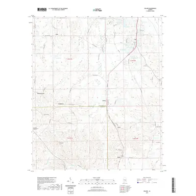
2020 Map of Sellers
USGS Topo · Published 2020About this map
The community of Fleta and the rural stretches of south Montgomery County define this landscape, where the headwaters of several creek systems begin their descent toward the Alabama River and the Gulf. This 2020 survey records the intricate network of county roads and family-named routes like Butler Mill Rd and Hobbie Rd that link small agricultural settlements. The transition from the Montgomery County plains into the northern edge of the Crenshaw Co line is marked by a scattering of local landmarks, including Mount Olive Missionary Baptist Church Cem and the Fair Prospect Cem. Numerous private impoundments and natural features such as Pintlala Cr and Bedsole Lake characterize the local drainage patterns. Genealogists will find value in the specific placement of historic cemeteries and named ponds like Cauthen Pond and Underwood Pond, which often serve as markers for long-standing family landholdings in the Ada and Sellers vicinities.
Find a feature on this map
82 named features on this map. Tap any name to fly to it.
Don’t see what you’re looking for? This feature index may not catch every label — zoom into the map to look around manually.
Map Details
Editions of this 2020 Sellers Map
This is the sole edition of this map. No revisions or reprints were ever made.
Other maps of this area

1953 · Montgomery
USGS Topo · 1:250,000

1953 · Andalusia
USGS Topo · 1:250,000

1956 · Montgomery
USGS Topo · 1:250,000

1957 · Montgomery
USGS Topo · 1:250,000

1957 · Andalusia
USGS Topo · 1:250,000

1957 · Letohatchee
USGS Topo · 1:62,500

1968 · Grady
USGS Topo · 1:24,000

1971 · Danielsville
USGS Topo · 1:24,000

1971 · Davis Crossroads
USGS Topo · 1:24,000
1971 · Ramer
USGS Topo · 1:24,000