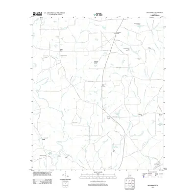
2011 Map of Sellersville
USGS Topo · Published 2011About this map
The Pea River snakes through this rural corner of Geneva County, defining a landscape of small agricultural settlements and family-named landmarks. The map records several long-established communities, including Leverett, Fairview, and Weeks, connected by a dense network of county roads. Industrial and commercial history is grounded in sites like Underwood Mill along Holley Branch and the local landmark of Holley Store. The area's genealogical record is particularly well-preserved, with numerous burial grounds such as Macedonia Cemetery, Haney Cemetery, and Friendship Cemetery scattered among the farmsteads.
Find a feature on this map
91 named features on this map. Tap any name to fly to it.
Don’t see what you’re looking for? This feature index may not catch every label — zoom into the map to look around manually.
Map Details
Editions of this 2011 Sellersville Map
This is the sole edition of this map. No revisions or reprints were ever made.
Other maps of this area

1942 · Enterprise
USGS Topo · 1:125,000

1950 · Enterprise
USGS Topo · 1:62,500

1953 · Andalusia
USGS Topo · 1:250,000

1953 · Dothan
USGS Topo · 1:250,000

1954 · Dothan
USGS Topo · 1:250,000

1955 · Dothan
USGS Topo · 1:250,000

1957 · Andalusia
USGS Topo · 1:250,000

1957 · Geneva
USGS Topo · 1:62,500
1957 · Geneva West
USGS Topo · 1:24,000
1957 · Coffee Springs
USGS Topo · 1:24,000