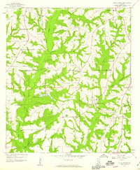
1957 Map of Coffee Springs
USGS Topo · Published 1959About this map
Coffee Springs serves as the focal point of this rural Southeast Alabama landscape, situated just south of the Coffee Co Geneva Co line. In the late 1950s, the region was defined by a dense network of small agricultural communities and country parishes, including Central City and Chancellor. The terrain is deeply dissected by numerous watercourses, most notably Double Bridges Creek and Beaverdam Creek, which dictated the winding paths of local roads and the placement of early homesteads.
Find a feature on this map
30 named features on this map. Tap any name to fly to it.
Don’t see what you’re looking for? This feature index may not catch every label — zoom into the map to look around manually.
Map Details
Editions of this 1957 Coffee Springs Map
Other maps of this area

1942 · Enterprise
USGS Topo · 1:125,000

1950 · Enterprise
USGS Topo · 1:62,500

1953 · Andalusia
USGS Topo · 1:250,000

1953 · Dothan
USGS Topo · 1:250,000

1954 · Dothan
USGS Topo · 1:250,000

1955 · Dothan
USGS Topo · 1:250,000

1957 · Andalusia
USGS Topo · 1:250,000

1957 · Geneva
USGS Topo · 1:62,500

1957 · Bellwood
USGS Topo · 1:24,000
1957 · Geneva West
USGS Topo · 1:24,000