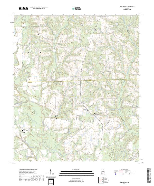
2024 Map of Sellersville
USGS Topo · Published 2024About this map
Pea River and its numerous tributaries, including Little Rocky Creek and Faulk Mill Creek, define the landscape of this region along the Coffee and Geneva county line. The agricultural and rural character of the area is evidenced by the concentration of family and community landmarks, such as Mount Olive Cem and Macedonia Cem. Small settlements like Weeks, Pera, and the northern edge of Samson are connected by a network of county roads, while industrial and agricultural history is hinted at by features like Faulk Millpond. The map also details several local spiritual centers, including Piney Grove Baptist Church and Carmel Baptist Church, which served as anchors for these rural Wiregrass communities. Significant water bodies like Ted Averett Lake and Lake Frankie provide additional points of interest within the varied terrain of the coastal plain.
Find a feature on this map
105 named features on this map. Tap any name to fly to it.
Don’t see what you’re looking for? This feature index may not catch every label — zoom into the map to look around manually.
Map Details
Editions of this 2024 Sellersville Map
This is the sole edition of this map. No revisions or reprints were ever made.
Other maps of this area

1942 · Enterprise
USGS Topo · 1:125,000

1950 · Enterprise
USGS Topo · 1:62,500

1953 · Andalusia
USGS Topo · 1:250,000

1953 · Dothan
USGS Topo · 1:250,000

1954 · Dothan
USGS Topo · 1:250,000

1955 · Dothan
USGS Topo · 1:250,000

1957 · Andalusia
USGS Topo · 1:250,000

1957 · Geneva
USGS Topo · 1:62,500
1957 · Geneva West
USGS Topo · 1:24,000
1957 · Coffee Springs
USGS Topo · 1:24,000