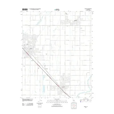
2012 Map of Selma
USGS Topo · Published 2012About this map
The agricultural heart of the San Joaquin Valley is anchored here by the established settlements of Selma and Kingsburg, connected by the dominant diagonal artery of S Golden State Blvd. This 2012 survey illustrates the grid-locked expansion of these valley towns, where residential developments meet extensive rural tracts such as Mulligan Farm and Lund Farms. The landscape is a testament to irrigation and transport, with the Kings River and Caesar Ditch carving through the southeastern corner near the Kingsburg border. Researchers will find a concentration of local history in the numerous burial grounds marking the area, including the Odd Fellows Cem and Floral Memorial Cem. Smaller points of interest like the Selma Speedway and the community of Wineland highlight the distinct character of the region's smaller hamlets and recreational sites.
Find a feature on this map
77 named features on this map. Tap any name to fly to it.
Don’t see what you’re looking for? This feature index may not catch every label — zoom into the map to look around manually.
Map Details
Editions of this 2012 Selma Map
This is the sole edition of this map. No revisions or reprints were ever made.
Other maps of this area

1922 · Trimmer
USGS Topo · 1:96,000

1923 · Malaga
USGS Topo · 1:31,680

1923 · Wahtoke
USGS Topo · 1:31,680

1923 · Sanger
USGS Topo · 1:31,680

1924 · Reedley
USGS Topo · 1:31,680

1924 · Selma
USGS Topo · 1:31,680

1924 · Conejo
USGS Topo · 1:31,680

1924 · Dinuba
USGS Topo · 1:125,000

1926 · Burris Park
USGS Topo · 1:31,680

1927 · Traver
USGS Topo · 1:31,680