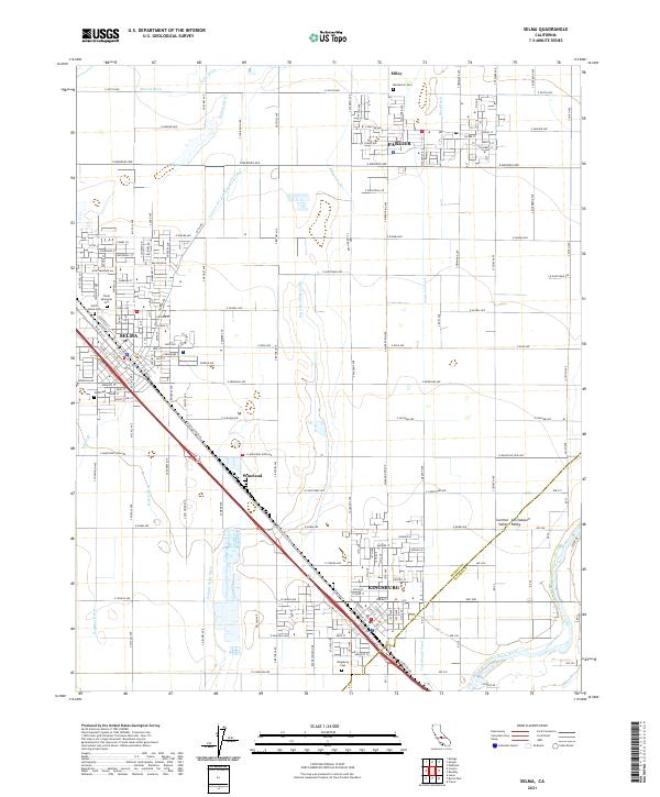
2021 Map of Selma
USGS Topo · Published 2021About this map
Selma and Kingsburg anchor this segment of the Central San Joaquin Valley, where a complex network of man-made waterways supports the region's agricultural productivity. The landscape is defined by the rigid grid of irrigation channels including the Centerville and Kingsburg Canal, Selma Colony Ditch, and Ward Drainage Canal, which draw from the Kings River in the southeast. This intensive water management system allowed for the growth of small settlements like Wineland and Miley alongside the primary rail corridor of the BNSF Railway. For those tracing family histories in Fresno County, the map identifies several local landmarks and burial grounds, such as North Selma Cem, Floral Memorial Cem, and Mendocino Cem near Parlier. The boundary between Fresno and Tulare counties is clearly marked as it traverses the rural landscape south of Kingsburg.
Find a feature on this map
119 named features on this map. Tap any name to fly to it.
Don’t see what you’re looking for? This feature index may not catch every label — zoom into the map to look around manually.
Map Details
Editions of this 2021 Selma Map
This is the sole edition of this map. No revisions or reprints were ever made.
Other maps of this area

1922 · Trimmer
USGS Topo · 1:96,000

1923 · Malaga
USGS Topo · 1:31,680

1923 · Wahtoke
USGS Topo · 1:31,680

1923 · Sanger
USGS Topo · 1:31,680

1924 · Reedley
USGS Topo · 1:31,680

1924 · Selma
USGS Topo · 1:31,680

1924 · Conejo
USGS Topo · 1:31,680

1924 · Dinuba
USGS Topo · 1:125,000

1926 · Burris Park
USGS Topo · 1:31,680

1927 · Traver
USGS Topo · 1:31,680