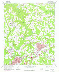
1964 Map of Selma
USGS Topo · Published 1976About this map
The Neuse River and its major tributaries, including Buffalo Creek, define the topography of this Johnston County landscape as it appeared in the mid-1960s. The regional economy is anchored by the rail corridors of the Southern, Coast Line, and Seaboard lines, which intersect at Selma and Smithfield. These transportation hubs show significant residential and industrial footprints, including the County Training Sch and a large municipal Sewage Disposal system.
Find a feature on this map
76 named features on this map. Tap any name to fly to it.
Don’t see what you’re looking for? This feature index may not catch every label — zoom into the map to look around manually.
Map Details
Editions of this 1964 Selma Map
3 editions found

Other maps of this area

1902 · Kenly
USGS Topo · 1:62,500

1903 · Kenly
USGS Topo · 1:62,500

1906 · Four Oaks
USGS Topo · 1:48,000

1908 · Four Oaks
USGS Topo · 1:62,500

1953 · Raleigh
USGS Topo · 1:250,000

1954 · Raleigh
USGS Topo · 1:250,000

1964 · Flowers
USGS Topo · 1:24,000

1964 · Selma
USGS Topo · 1:62,500

1964 · Clayton
USGS Topo · 1:24,000

1964 · Powhatan
USGS Topo · 1:24,000