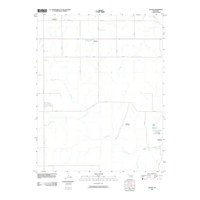
2010 Map of Selman
USGS Topo · Published 2010About this map
Buffalo Creek winds extensively through this portion of Harper County, carving a drainage pattern that dominates the local landscape. The settlement of Lovedale sits near the southeastern corner, serving as a focal point for the section-line road network that defines the region's agricultural layout. This 2010 survey reflects a period focused on water management and conservation, as evidenced by numerous numbered reservoirs and dams scattered across the terrain. Significant water features like Oknoname 05911 Reservoir and Selman 23 Reservoir indicate the ongoing efforts to capture runoff in this semi-arid environment. The confluence of Buffalo Creek and Sand Creek near Lovedale highlights the natural geography that influenced early ranching and farming settlement patterns in the Oklahoma panhandle region.
Find a feature on this map
28 named features on this map. Tap any name to fly to it.
Don’t see what you’re looking for? This feature index may not catch every label — zoom into the map to look around manually.
Map Details
Editions of this 2010 Selman Map
This is the sole edition of this map. No revisions or reprints were ever made.
Other maps of this area

1955 · Woodward
USGS Topo · 1:250,000

1958 · Woodward
USGS Topo · 1:250,000

1970 · Lookout
USGS Topo · 1:24,000

1970 · Buffalo SE
USGS Topo · 1:24,000

1970 · Selman NW
USGS Topo · 1:24,000

1970 · Buffalo NE
USGS Topo · 1:24,000

1970 · Sleeping Bear Creek NW
USGS Topo · 1:24,000

1971 · Selman SE
USGS Topo · 1:24,000

1971 · Selman
USGS Topo · 1:24,000

1971 · Fort Supply NE
USGS Topo · 1:24,000