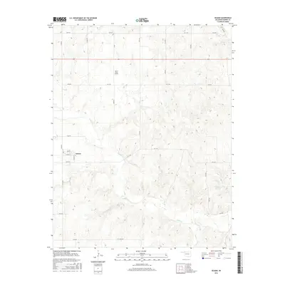
2016 Map of Selman
USGS Topo · Published 2016About this map
Selman serves as the central hub of this Harper County landscape, where the local street grid is defined by Main St, Eilerts St, and Weaver St. The town sits at the intersection of several section-line roads that crisscross the undulating terrain of northwestern Oklahoma. The drainage patterns of Buffalo Cr and Sand Cr carve through the geography, leading toward the Selman 23 Reservoir in the eastern portion of the sheet. Aviation interest is noted at Mike's Place Airport, a small airfield situated north of the town center. The map reflects a predominantly rural character, where the vast network of county roads like NS 201 Rd and EW 15 Rd supports an agricultural and ranching economy, connecting remote farmsteads to the settlement at Selman.
Find a feature on this map
32 named features on this map. Tap any name to fly to it.
Don’t see what you’re looking for? This feature index may not catch every label — zoom into the map to look around manually.
Map Details
Editions of this 2016 Selman Map
This is the sole edition of this map. No revisions or reprints were ever made.
Other maps of this area

1955 · Woodward
USGS Topo · 1:250,000

1958 · Woodward
USGS Topo · 1:250,000

1970 · Lookout
USGS Topo · 1:24,000

1970 · Buffalo SE
USGS Topo · 1:24,000

1970 · Selman NW
USGS Topo · 1:24,000

1970 · Buffalo NE
USGS Topo · 1:24,000

1970 · Sleeping Bear Creek NW
USGS Topo · 1:24,000

1971 · Selman SE
USGS Topo · 1:24,000

1971 · Selman
USGS Topo · 1:24,000

1971 · Fort Supply NE
USGS Topo · 1:24,000