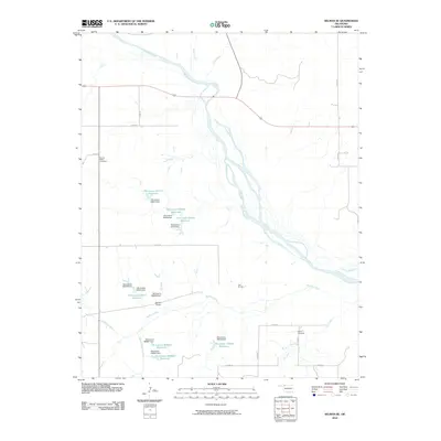
2010 Map of Selman SE
USGS Topo · Published 2010About this map
The Cimarron River dominates this portion of Woodward County, branching through the landscape alongside numerous tributaries like Buffalo Creek and Elm Creek. In this 2010 survey, the rural character of northwest Oklahoma is defined by a significant water management network, featuring a series of numbered reservoirs and dams such as Selman 9 Dam and Oknoname 05918 Dam. These structures suggest a focused effort to manage the local watershed for ranching or agricultural use in a semi-arid region.
Find a feature on this map
35 named features on this map. Tap any name to fly to it.
Don’t see what you’re looking for? This feature index may not catch every label — zoom into the map to look around manually.
Map Details
Editions of this 2010 Selman SE Map
This is the sole edition of this map. No revisions or reprints were ever made.
Other maps of this area

1955 · Woodward
USGS Topo · 1:250,000

1958 · Woodward
USGS Topo · 1:250,000

1970 · Alabaster Caverns
USGS Topo · 1:24,000

1970 · Lookout
USGS Topo · 1:24,000

1970 · Freedom NW
USGS Topo · 1:24,000

1970 · Edith
USGS Topo · 1:24,000

1970 · Selman NW
USGS Topo · 1:24,000

1970 · Sleeping Bear Creek NW
USGS Topo · 1:24,000

1971 · Selman SE
USGS Topo · 1:24,000

1971 · Selman
USGS Topo · 1:24,000