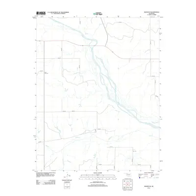
2012 Map of Selman SE
USGS Topo · Published 2012About this map
The braided channels of the Cimarron River dominate this landscape in northwestern Oklahoma, cutting a wide path across Woodward County. The river's vast sandy bed is joined by several tributaries, including Day Cr, Keno Cr, and Buffalo Cr, which carve through the plains. This 2012 survey illustrates a sparsely populated agricultural region defined by a rigid section-line road grid, where travel is facilitated by routes like e0100 RD and n2070 RD. For local history and genealogy, the map identifies two rural burial sites: Spring Valley Cem in the northwest and Nixon Cem near Elm Cr in the southeast. These cemeteries, alongside family-named watercourses like Sleeping Bear Cr, provide essential landmarks for tracing the settlement patterns of this plains community.
Find a feature on this map
24 named features on this map. Tap any name to fly to it.
Don’t see what you’re looking for? This feature index may not catch every label — zoom into the map to look around manually.
Map Details
Editions of this 2012 Selman SE Map
This is the sole edition of this map. No revisions or reprints were ever made.
Other maps of this area

1955 · Woodward
USGS Topo · 1:250,000

1958 · Woodward
USGS Topo · 1:250,000

1970 · Alabaster Caverns
USGS Topo · 1:24,000

1970 · Lookout
USGS Topo · 1:24,000

1970 · Freedom NW
USGS Topo · 1:24,000

1970 · Edith
USGS Topo · 1:24,000

1970 · Selman NW
USGS Topo · 1:24,000

1970 · Sleeping Bear Creek NW
USGS Topo · 1:24,000

1971 · Selman SE
USGS Topo · 1:24,000

1971 · Selman
USGS Topo · 1:24,000